
With climate change, growing populations, and increasing urbanization, municipal wastewater effluent is having a greater impact on our surface water systems. When treated wastewater is discharged into streams, it carries along complex mixtures of contaminants of global concern—including pharmaceuticals, personal care products, and per- and polyfluoroalkyl substances (PFAS).
To understand how these contaminants migrate and attenuate, studies that focus on the hyporheic zone—the critical region beneath and adjacent to a stream bed where surface water and groundwater mix—are essential. These zones have strong potential for contaminant attenuation.
Historically, tracking water movement and contaminant concentrations across high-resolution vertical profiles in shallow streambeds has been challenging. Traditional approaches, such as clustering individual piezometers, create a large footprint that risks instrument damage from river debris and introduces lateral errors in head measurements. Meanwhile, standard bundle piezometers can suffer from preferential flow paths or tube damage during manual installation.
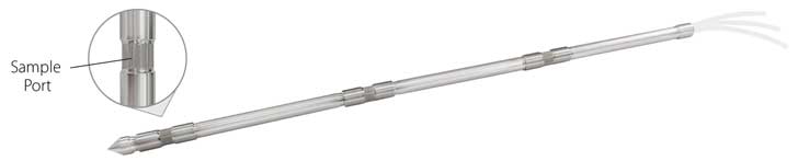
In a recent study published in Hydrological Processes, a team of researchers from the University of Iowa and the U.S. Geological Survey (USGS) used a novel tool—the Solinst Model 615ML Multilevel Drive-Point Piezometer—to tackle these challenges.
The Challenge: Monitoring a Flashy, Effluent-Dominated Stream
The research team, led by Jessica R. Meyer, selected Muddy Creek in east-central Iowa as their field site. Muddy Creek is a well-studied, temperate-region effluent-dominated stream (EDS) where treated wastewater effluent contributes most of the stream’s total discharge during low-flow periods.
Because wastewater inputs create rapid, diurnal fluctuations in stream stage, the site represents a highly dynamic and complex hydrological environment. The field instrumentation needed to meet specific criteria:
- It had to be highly portable, as the channel is only accessible on foot.
- It had to withstand flashy hydrology, high water velocities, floating debris, and winter ice formation.
- It had to collect accurate, depth-discrete groundwater samples and hydraulic head measurements along a single profile to isolate vertical flow paths.
The Solution: Solinst Multilevel Drive-Point Piezometers
To overcome these environmental hurdles, the team deployed Solinst 615ML Multilevel Drive-Point Piezometers (DP-MLS). These piezometers scale down the proven design of the Waterloo Multilevel System, allowing up to 6 depth-discrete ports to be threaded onto small-diameter (1.9 cm) stainless steel drive-point riser pipes (3/4” NPT). Each screened port has a barb for connecting sample tubing that runs to the surface.
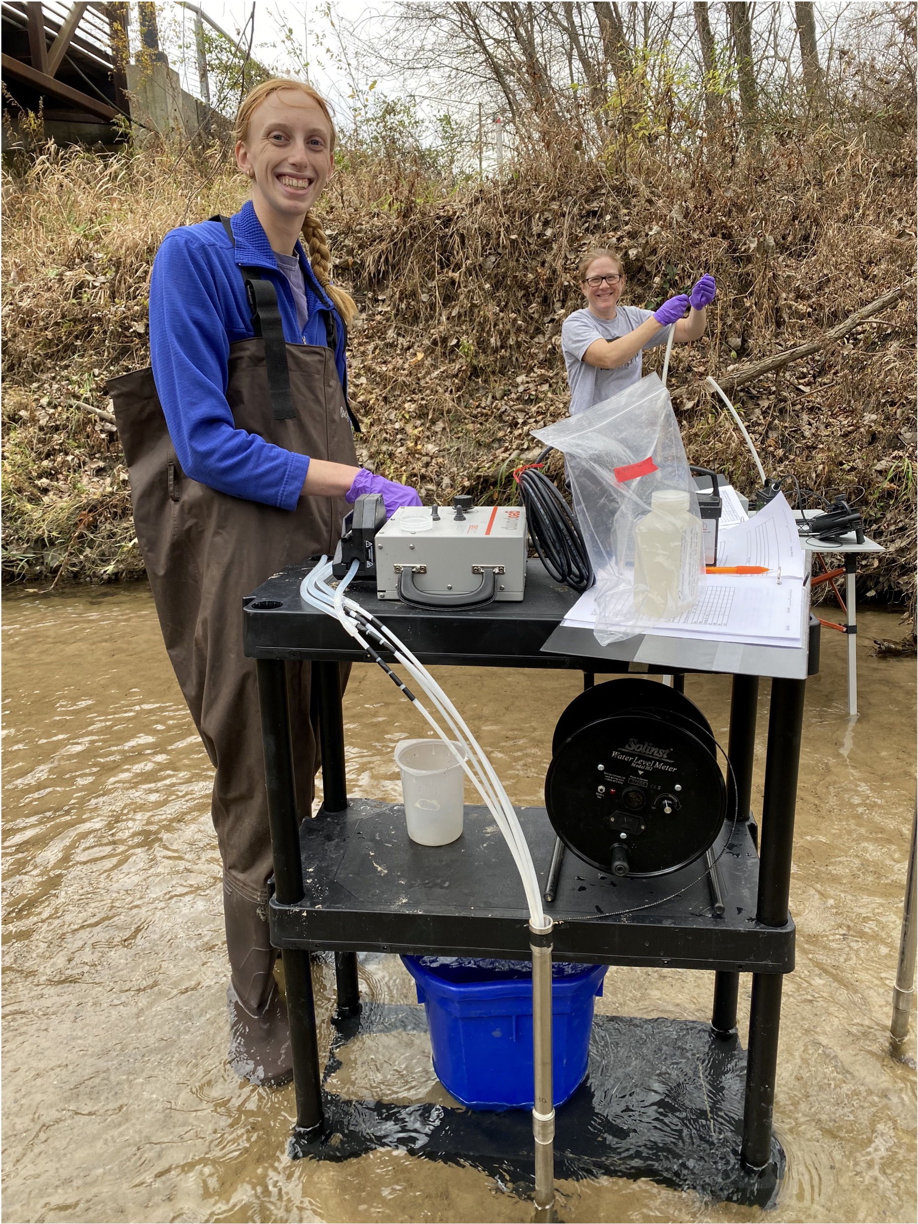
For the Muddy Creek study, the researchers configured custom 2-port and 4-port systems utilizing High-Density Polyethylene (HDPE) tubing selected specifically for its chemical compatibility with PFAS and organic contaminants. They were installed at two different sites along the river, with two 2-port systems and one 4-port system at each location.
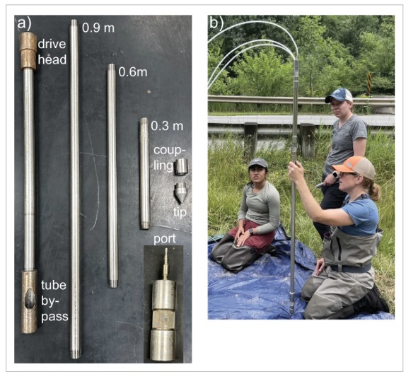
Installation was completed manually on-site. The team first used a standard single-interval Solinst drive-point piezometer to “probe” the bed, identifying a geological transition zone based on driving resistance—moving from the loose, sandy sediments of the Camp Creek Member into the more compacted Gunder Member. Using this stratigraphic data, they built and customized the port depths of the Multilevel Drive-Point Piezometers directly in the field from the bottom up, before driving the completed systems to their target depths with a simple 7 kg slide hammer.
To protect the internal tubes during installation, the team used a Solinst drive head with a tubing bypass, ensuring that the internal lines emerged unharmed and exactly at their design depths. Through field testing, it was found that installing with a temporary casing helped prevent ports from being clogged in clay and silt conductions.
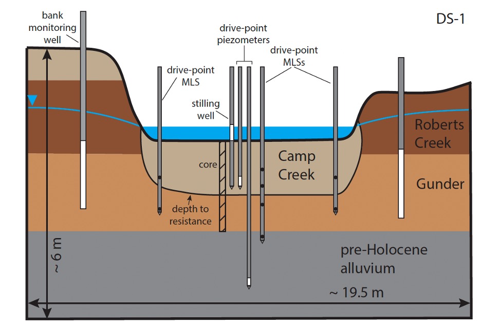
Each study site also included two standard drive-point piezometers, a drive-point stilling well for measuring stream stage, and stream bank monitoring wells equipped with pressure transducers that collected data every 5 min. Data from the standard drive-point piezometers and stilling wells provided temporal context for data collected from the DP-MLS.
High-Resolution Field Insights
Over a comprehensive 2-year monitoring campaign, the DP-MLS proved its excellent structural durability, surviving rapid water stage changes, floating debris, and river ice.
Beyond its ruggedness, the system yielded vital insights into how emerging contaminants interact with local groundwater:
The high-resolution head profiles measured from the DP-MLS revealed that vertical hydraulic gradients varied significantly in magnitude and direction with depth. Traditionally, researchers only measure head from a single depth, assuming a uniform gradient.
1. Unmasking True Hydraulic Gradients
By measuring multiple depth-discrete intervals from a single system with a unified reference point and a Solinst Model 102 Narrow Water Level Meter, the team avoided lateral errors. The DP-MLS showed that conventional clustered piezometers underestimated the upward gradient by 2 to 3 times and completely missed critical localized downward gradients.
2. PFAS and Pharmaceutical Penetration
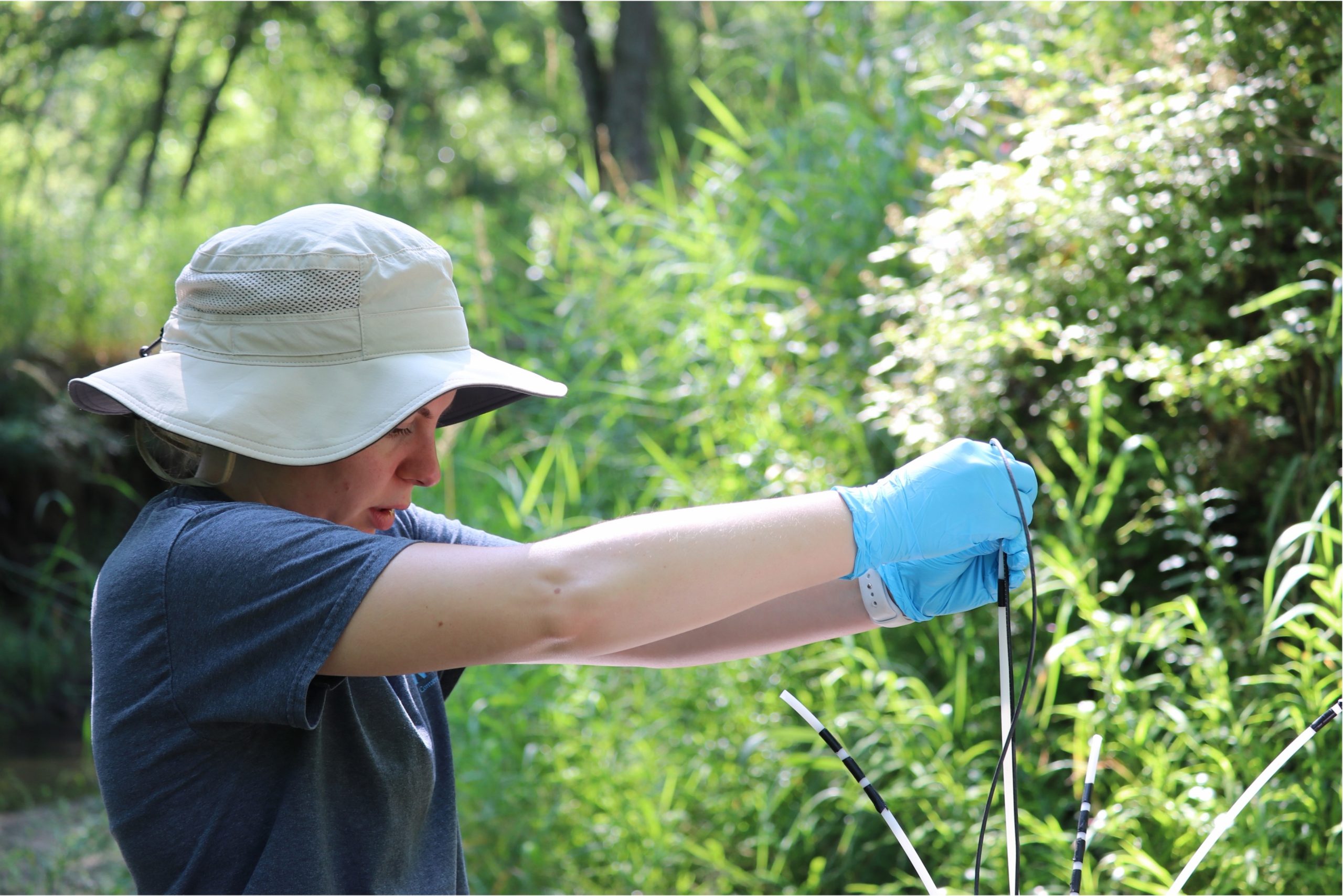
Groundwater sampled via a peristaltic pump connected to the DP-MLS lines mapped how far wastewater contaminants traveled into the stream bed:
- At Site DS-1 (0.2 km downstream of the outfall), strong upwelling groundwater successfully acted as a hydraulic barrier, keeping pharmaceutical and PFAS concentrations lower and restricting their penetration into deeper bed sediments.
- At Site DS-2 (4.7 km downstream), the upward gradients were much weaker. The physical and chemical data collected by the DP-MLS revealed that during storm events, high stream stages easily reversed these weak gradients. This allowed wastewater-derived pharmaceuticals and PFAS (such as PFOA and PFOS) to consistently penetrate over 1 meter deep into the streambed porewater.
The Takeaway
The University of Iowa and USGS study demonstrates that understanding the fate of contaminants of global concern requires highly precise, high-resolution physical and chemical data.
The Solinst Multilevel Drive-Point Piezometers proved to be an ideal solution for this shallow, dynamic ecosystem. They combine the rugged portability needed for manual river-bed installations with the multi-port capability required to accurately profile complex chemical and hydraulic boundaries. For groundwater professionals and limnologists investigating hyporheic exchange, the DP-MLS represents a reliable path forward for high-resolution subsurface characterization.
To learn more about how to configure Multilevel Drive-Point Piezometer System for your next streambed or shallow monitoring project, visit our product page or contact a Solinst technical representative.


