It is widely understood that to properly and sustainably manage the world’s groundwater resources, collecting data on its quantity and quality is essential. Efficient, cost-effective options for accessing, storing, and sharing the data are needed to balance out the increased demand.
Telemetry is one data retrieval method that is used extensively in environmental applications, but it is often seen as an expensive and complicated option for monitoring groundwater levels. However, recent advancements in technologies provide flexible, more affordable options, especially when monitoring at various scales, is required.
The Hydrologic Sciences Graduate Group at the University of California, Davis (UC Davis) has established a low-cost, open source network of on-demand aquifer monitoring sites with the help of Solinst LevelSender telemetry systems.
The LevelSender is a compact, simple, low lost telemetry device. It uses cellular communication to send water level data from remote Levelogger water level dataloggers in the field to a Home Station computer and/or smart devices via e-email and SMS. Get a Quote for your project!
The network of LevelSender systems is set up as part of a pilot study for real-time groundwater monitoring on a Subbasin scale (the South American Subbasin Groundwater Observatory).
In 2017, the group began by installing a number of LevelSender systems in the South American Subbasin between the American and Cosumnes Rivers, in California. Several stakeholders and landowners in the region have allowed access to their wells as part of the program. Currently, there are ten LevelSender systems providing data to the Groundwater Observatory.

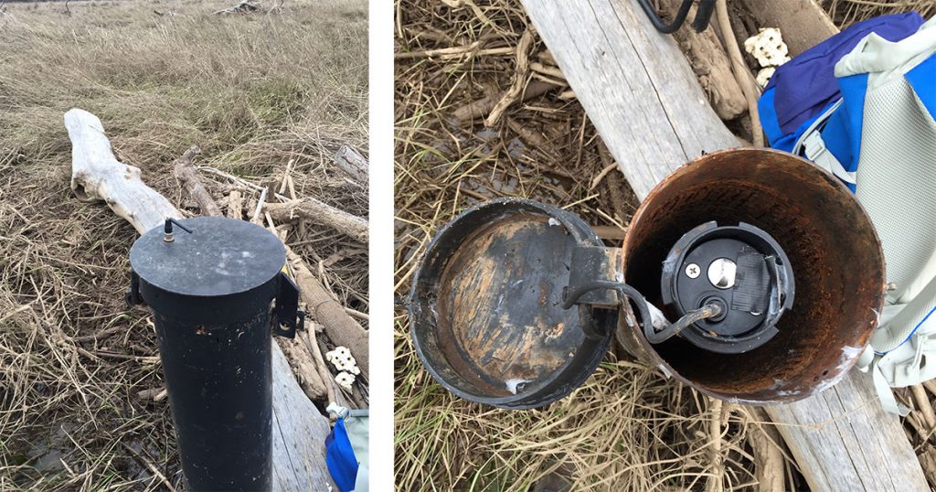
About half of the LevelSender devices are installed in 2″ diameter groundwater monitoring wells. The compact LevelSender units sit inside the casing at the top of the well. (As some wells have metal enclosures, the project team has extended the antenna to reach the outside the well cap for better data transmission.)
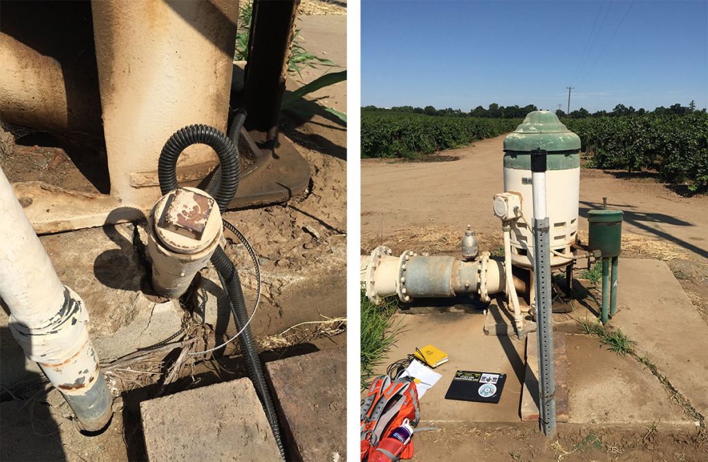
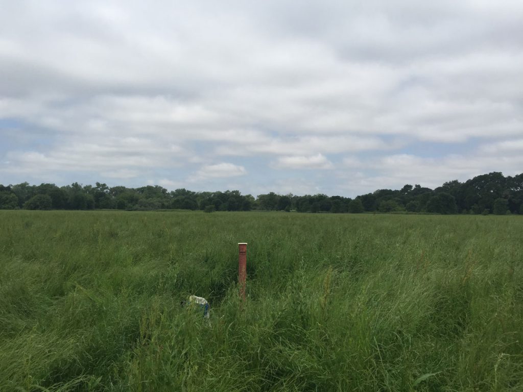
The other LevelSender systems are deployed adjacent to wells (some agricultural pumping wells) on stakes or in a casing with connection cables running along the ground in protective pipes. The connected Leveloggers are installed through small access points to the well.

Each LevelSender system has one connected Levelogger water level datalogger. A Solinst Barologger is deployed in the project area to provide air pressure data for barometric compensation of the water level data provided by the Leveloggers.
The LevelSender units collect hourly water level and temperature readings from the connected Leveloggers. The LevelSenders then report the accumulated data once per day to the Home Station email. The dataloggers themselves record data internally as a backup if circumstances require it.
Solinst LevelSender telemetry has the advantage of flexible data transmission, storage, and sharing options. LevelSender data can be accessed in a number of different ways:
- On the Home Station computer:
- Each data report sent to the Home Station email can be viewed using LevelSender Software. Data files can be exported from the Software for use in other programs.
- Data from each report is placed in an SQLite database. The database is appended with each report. The database can be queried by macros or applications to automatically check for updates and display the data on websites or another custom setups.
- In addition to the Home Station email, five other emails can receive data reports. This enables multiple project partners to receive the data on their own computers or smart devices.
- Data can also be sent via SMS to one phone number.
The user is in complete control of their own data – no data storage or hosting fees!
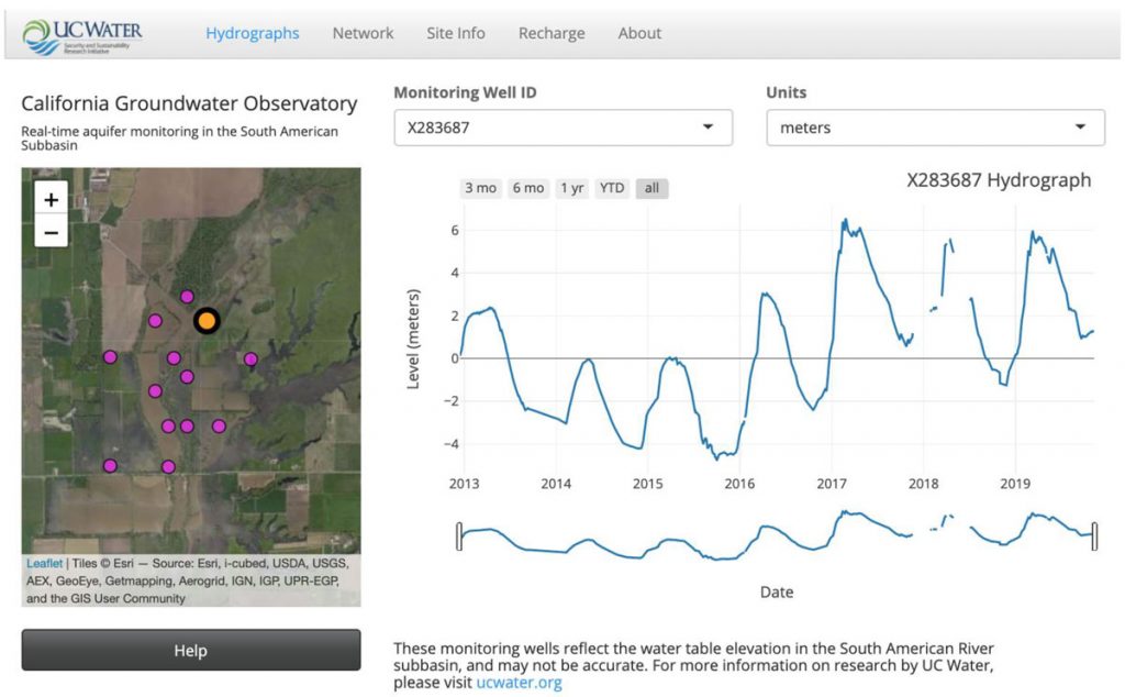
The group at UC Davis is using the groundwater data sent to the SQLite database on their Home Station computer to post to a web dashboard. The data is available for anyone to view on the website: the UC Water California Groundwater Observatory at http://ucwater.org/gw_obs/

The online Groundwater Observatory allows researchers, water managers, and all stakeholders in the region to access up-to-date water level data. The source of continuous data also provides a better understanding of the long-term trends in groundwater level changes in the basin. This better equips those in the region to make appropriate decisions on groundwater management.
In addition to providing input to the Groundwater Observatory, the group uses the data to monitor real-time changes in groundwater to investigate floodplain recharge. As part of this study, they are looking to determine whether groundwater elevation rises above the nearby river’s thalweg (the line of lowest elevation within the watercourse). Ultimately, the aim is to research the impact of managed aquifer recharge in the subbasin.
The data is also exported to .csv files that are saved on a server for day-to-day use in other research, as well as for backup.
The group notes that the primary advantage of the network of telemetry systems is automating the retrieval of data, which greatly reduces field visits and allows data visualization when weather or field conditions do not permit sites visits.

Each report from a LevelSender contains diagnostic information including battery level. This allows the staff to monitor the system status remotely. The systems reduce the number of wells that need to be visited on actual field days, and provide more immediate updates on water levels, which are useful to plan when future site visits are required.
The group recently published a paper in Water titled Low-Cost, Open Source Wireless Sensor Network for Real-Time, Scalable Groundwater Monitoring that describes the use of the LevelSender systems in the network. The article can be accessed online here: https://www.mdpi.com/2073-4441/12/4/1066
The paper includes a cost comparison between low cost, open-source telemetry systems (in this case the LevelSender) versus taking manual water level measurements. The researchers provide a strong argument that telemetry is a very efficient and more cost-effective option for retrieving the required amount of water level data for groundwater monitoring networks.
Solinst thanks Andrew Calderwood and Alysa Yoder, of UC Davis, for providing the details of the project.
